Monday, October 24, 2016

Waipakihi Wanderings

Labour Weekend is always a good excuse to head for the hills, so this year I dragged a few friends down to the Kaimanawa Ranges (east of Ruapehu).


Day 1 was up and over the Urchin track, then picking our way up the Waipakihi River for 3 hours. To start with this was nice tussock flats, interspersed with deer trails through the scrub, but as we got further upstream it turned into more of a scrub bash. At 6pm we found a spot on the river bank for our bivvy bags and settled in for the night. It was clear and cold - there was frost forming before we went to bed. Lying in my sleeping bag gazing up at the stars I had a sense of contentment and satisfaction.

Camping beside the Waipakihi River

Reluctantly we donned our frozen shoes and socks in the morning to continue up the river for 1 1/2 hours. We were soon in the sunshine and cold feet were forgotten. Turning off up to Middle Range signalled the next stage of our trip. A stiff climb up on to the tops then several kilometres of rolling ridge travel. Cloud was brushing the high point at 1660m as we ascended, but dispersed before we got up there. This was my first time leading an off-track trip so I was glad to have good visibility to navigate. Progress was fairly quick, and it was satisfying to be able to look back and trace out the route we had come. Reaching Thunderbolt was a non-event as despite the name it is merely another rounded bump on the ridge. Motutere marked the beginning of the steep descent through the beech forest down into the Waipakihi River. On the flats opposite the track end we found a campsite in the edge of the bush, where there was also a hunter's bivvy and more good tent sites nearby. We got a campfire going and enjoyed the evening. Much warmer than the previous night!

We had come along the ridge from the high point on the left

At the end of Middle Range (Motutere)

Waking up under the beech trees to melodic birdsong and the rich smell of forest was very peaceful. A relaxed breakfast and then we strolled half an hour down the river flats to the Urchin track. From here it was just a stiff climb up and over the Urchin and down the other side to the car. A very satisfying weekend adventure!

Camp 2


Tuesday, August 16, 2016

Ringatoto

Mt Ruapehu is well known as the highest mountain in the North Island, but the volcano actually has 12 prominent peaks not just a single summit.

I climbed my first of the peaks before I was 10 on a family summer-time scramble up to Dome. The true summit, Tahurangi, was achieved in 2009 and at the time I found it pretty scary. Te Heuheu was memorable as my first solo alpine ascent, and my favourite climb was Girdlestone last year. Gradually the various peaks were ticked off the list until only one remained: Ringatoto.

The east ridge of Ringatoto

Escaping from work at lunch time on Wednesday, it was a long drive down to the eastern side of Ruapehu and halfway up the 4WD Tukino Road. The last flush of twilight faded as we set off through the snow towards Rangipo Hut. It was a glorious clear night with only the faintest mountain zephyr and a bright moon illuminating the landscape. The snow was soft and deep so crampons weren't required. Dad took on the unenviable role of breaking trail through the at times knee-deep snow. It was exhausting work doing repeated one-legged squats with a heavy pack.

Rangipo Hut

From previous tramps I expected to reach Rangipo Hut in 2 hours, but it was an extra 45 minutes before it finally appeared. Snow was piled around the hut and it took 10 minutes to clear snow from in front of the door. Once inside it was straight into our cozy sleeping bags, hoping for the snow to freeze overnight.

Still soft. Abandoning our original plan of traversing over Ringatoto to Tahurangi, around the crater lake then down to Whangaehu Hut we instead opted to leave our sleeping gear at Rangipo and simply tackle the east ridge Ringatoto. This meant lighter packs and far less post holing through the soft snow.


An intense orange glow spread across the horizon as we headed up the ridge behind the hut. Layers were soon being peeled off as the sun warmed us up and there was no cooling breeze. After an hour we donned crampons as there was a hard layer under the surface snow in places. The vista was grand: white-capped Kaimanawa Ranges to the east, to the north Ngauruhoe was cloaked in snow with Lake Taupo beyond, and Te Heuheu, Cathedral Rocks, Pyramid and Girdlestone forming the eastern ramparts of Ruapehu.


The easy ridge walking gave way to steeper terrain with a few sidling traverses and short mixed rock steps but nothing too difficult. We used the rope twice for security where there was loose snow on steep rock. The final pinch up to the shoulder of Ringatoto was up a steep firm gully - the only decent snow on the whole climb! We soloed up and I was reasonably comfortable, albeit tired by the time I topped out onto easy ground. A short stroll led to the summit. Peak number 12 accomplished!

On top of Ringatoto with Tahurangi behind

The weather was still perfect so we spent half an hour soaking in the grandeur of the mountain before retracing our steps. Dad belayed me down the gully, and then apart from a very short abseil down a rock step it was all straight forward back to Rangipo.


7 hours from Rangipo hut to Ringatoto
3.5 hours down


The 12 peaks of Ruapehu

Tahurangi (2,797m)
Te Ataahua (2,757m)
Paretetaitonga (2,751m)
Te Heuheu (2,732m)
Tukino (2,720m)
Dome (2,672m)
Cathedral Rocks (2,663m)
Girdlestone (2,658m)
Pyramid (2,645m)
Glacier Knob (2,642m)
Ringatoto (2,591m)
L Peak (2,580m)

Tuesday, June 7, 2016

Kaweka Ranges

The forecast promised 4 days of calm, clear weather over Queen's Birthday Weekend - perfect for my first foray into the Kaweka Ranges. As it turned out, the weather was even better than we could have hoped. Blue skies and no wind for the entire weekend!

Day 1
The Lakes -> Manson Hut

A temperature of zero degrees at the carpark was a good incentive to get going quickly and tackle the 500m climb up to Kuripapango. Within 10 minutes we were well and truly warm! We were excited when the first patched of snow appeared near the top. For a short time cloud came in but soon dissipated to become a glorious day with not a breath of wind. All of a sudden we rounded a corner to see Ruapehu and Ngauruhoe standing majestically in the distance.


I was reveling in the adventure and couldn't stop smiling all day. We took the Cameron track through the bush, skipping Kiwi Saddle Hut. It was a thigh-trembling 600m steep descent down to Kiwi Mouth hut. Luckily for us the exposed clay slopes were slightly sticky - it would be nasty going down when wet (or dry and crumbly). It was only 2pm when we reached Kiwi Mouth so we decided to push on to Manson Hut for the night after a rest in the sunshine to brew coffee and tape feet. Up on the tops there were some lovely alpine meadows.


Nearing Manson Hut

 Just as we turned off the ridge toward the 6 bunk Manson Hut the grin was wiped off my face the thud thud thud of an approaching chopper. Hoping against all hope that it would carry on to Kiwi Mouth we watched as it homed in on Manson. Breaking into a trot we raced to the hut, coming to the clearing just as the helicopter touched down. We snuck in to claim our bunks as 4 men climbed out of the chopper - and then announced there was another load coming! We debated whether we should sleep outside (Amanda wanted to test her new tent) but opted to stay inside as we reasoned that being trampers, not hunters, the blokes wouldn't be too bad as hut mates. We were wrong and later regretted it.

After exploring the historic musterers' hut nearby we returned as the remaining 3 'trampers' got dropped off. It was their annual reunion tramp and they were doing it in luxury, having done a food drop for their second night as well. It was crowded with 9 people inside the small hut and soon got pretty hot and stuffy with the fire going. After a couple of beers each, they were then into their whiskey - each had brought a 700ml bottle for the weekend. The conversation soon got pretty loud. Amanda and I were ready to hit the sack before 7pm as we had been up early and done a hard walk. Thankfully the party stopped at 9:30pm - in the morning one of the guys boasted that he couldn't remember getting out his sleeping bag or why he was out on the deck. This would have to be one of my worst hut experiences so far in the backcountry and left a sour taste. (okay, I know it's not that bad compared to what some people put up with but it still wasn't pleasant!).

Manson Hut

1:05 hrs to Kuripapango
3:44 hrs to Cameron Hut / Kiwi Mouth junction
5:19 hrs to Kiwi Mouth Hut
8:19 hrs to Manson Hut


Day 2
Manson Hut -> Mangaturutu Hut

Up and out of the hut in the morning as quickly as possible; I was desperate to get away from the noise of the 7 guys. It was frosty along the rolling open tussock with a dusting of snow making for pleasant going. This was my favourite part of the whole trip!

Manson Tops

A very steep descent down to Rocks Ahead stream. The cableway across the stream is not built for short people - I could barely reach the winch handle at the top of its swing, let alone exert much force. Luckily there is also a winch handle inside the cage, so with one person winding from the bank and the other assisting from the cage we managed to get safely across. An excellent arm workout! Had lunch in a warm little spot of sunshine in front of Rocks Ahead Hut. An icy 3 wire bridge to cross and then it was up, up, up to Venison Top. The 2 hour climb was steep and relentless, seeming to go on forever. As we got higher there was lots of snow on the ground making it look like a scene from Narnia. I wouldn't have been surprised to see a faun trotting out.

The main Kaweka Range

We reached Venison Tops Hut (aka Kelvinator Lodge) to find Chris Townley asleep in the sunshine. He had run in from Makahu Road to meet us for the night. After a sit-down in the sun it was time to carry on for another hour and a half to Mangaturutu Hut for the night. Chris ran ahead and had the fire going by the time we arrived. The hut was nice and cosy with the fire roaring. I stood outside stargazing for a while before retreating to bed at 7:30pm.

1 hr to Manson
3:22 hrs to Rocks Ahead Hut
6:20 hrs to Venison Tops Hut
8:09 hrs to Mangaturutu Hut


Day 3
Mangaturutu Hut -> Studholm Saddle Hut

The eastern horizon was blazing orange as we headed out the door before 7am, headlights on for a while until the sun came up. A long descent down to Makino River, where I saw a pair of whio by the walkwire. A nice flat section along the river brought us to the first of many climbs for the day up to the Makino Hut turnoff. Chris caught us up just before the top, then turned left to head out to his car. We turned south towards the main range through nice open beech forest. There were several kereru along here and there seemed to be more birds than elsewhere in the park. Perhaps because of the predator trapping going on in this area? After 4 hours I was glad to get out into the open as with such glorious weather it seems a pity to be down in the trees.

Ascending Whetu

The climb up to Whetu was steep and loose, the hard work making us eager for lunch. There was no snow on the northern face, but descending off the back of Whetu we struck the first snow for the day. It wasn't much and most of the time we broke through the crust. There was a sketchy bit sidling under Kaweka North were the track crossed an icy gully so we climbed up higher using the plants for purchase to avoid the ice. Reaching Kaweka J, the highest point in the Kawekas at 1,725m, was an anticlimax as it is barely a bump on the ridge. There was a cool breeze and by this time we were eager to get off the snow so after the obligatory photos we carried on south.

Kaweka J (1,725m)


We met up with two guys, Brian & Richard, who were heading down to Studholm Biv so we joined for a while. Dropping off Mad Dog was icy and slippery. Our ice axes were put to good use, and in hindsight I should definitely have put my crampons on as well. When planning the route I hadn't considered that traversing the tops from north to south would mean descending the icier southern slopes. Farewelling Brian & Richard at the biv we had a false start when I turned the wrong way at the stream. Things didn't look right and I soon corrected my error when I remembered that the track is marked wrongly on the map. We found the hut tucked away in the snowy bush just on dusk. A warm fire, hot drinks and a hearty meal made for a pleasant evening.

1:30 hrs to Makino River
3:05 hrs to Makino Hut turnoff
5:10 hrs to Whetu
7:56 hrs to Kaweka J
9:21 hrs to Studholm Biv turnoff
10:05 hrs to Studholm Saddle Hut

Day 4
Mangaturutu Hut -> The Lakes Carpark
A nice lazy morning involving breakfast in bed (a benefit of claiming the bunk next to the bench) and multiple hot drinks. With long hours of darkness we got plenty of sleep on this trip! After replenishing the wood supply we headed off, meeting up with Richard & Brian as we passed the biv. Half an hour of climbing saw us back atop the main ridge. From here it was undulating south along the ridge and over the tits, from where we dropped down the marked route through Cooks Horn Basin. This was pretty steep; frosty scree among pine trees at first, then changing to nice beech forest. The track from the old Kaweka hut site had me a little puzzled as the track is marked incorrectly on the map. 2km before the carpark my personal record-breaking streak of 3 days without getting wet shoes came to an end at the Tutaekuri River.

3:30 hrs to The Lakes carpark

Mangaturutu Hut

Thursday, March 3, 2016

Mt Aspiring

The brave man is not he who feels no fear,
For that were stupid and irrational;
But he, whose noble soul its fear subdues,
And bravely dares the danger nature shrinks from.
~ Joanna Baillie
 
Often referred to as New Zealand's Matterhorn, Mt Aspiring has a distinctively aesthetic profile. At 3,033m it stands as one of NZ's 25 highest mountains and is also one of the more achievable 3,000m peaks. Ever since another climbing / tramping expedition 2 years ago, where we camped in sight of Mt Aspiring, I have harboured the desire to reach the summit. 

 
It was getting a bit late in the season but we pencilled in late-February for the climb. A close eye was kept on the weather forecast so when Metvuw showed a few days of settled weather arrangements were hastily made. Dad and I soon found ourselves in Wanaka ready to head into the mountains.
 
With a limited weather window and work constraints we opted to helicopter in to Bevan Col in order to save two days of arduous tramping. From the col it took 2 hours to cross the Bonar Glacier - another new experience for me. I took the time to peer down into a few crevasses but most were fairly small and easily stepped across. Colin Todd Hut stood out like a beacon up on Shipowner Ridge. The hut windows look straight out at the summit of Mt Aspiring and the Northwest Ridge, so we were able to get a good look at our planned route.

 
4am. Time to get up. With clear skies and a full moon it was quite light outside and the mountain stood out clearly. Geared up and out the door before 5am, it was half an hour up the rocky path to the snow slope above the Iso Glacier. Crampons on for a nice plod up to the NW Ridge. Dawn broke and the red moon set as we abandoned crampons for the rock on the main ridge. Immediately there was an airy ledge to traverse so the rope came out (and stayed out until this spot on our return). Dad short-roped me for most of the climb; simulclimbing in a few places and belaying on the sketchier bits.
 
I was really noticing the exposure on the ridge and was not too happy with having nothing on either side for a couple of hundred metres below! Inching across a ledge with your heels hanging over mid air and fingers clinging to small pockets in the rock it a little terrifying. Halfway along the ridge I got pretty petrified on a traverse and almost decided to turn back. Only the thought of everything we had poured into this trip, and the desire not to fail, kept my moving forward. A few moments on solid ground clinging to a rock to regain composure and I resolved to carry on. I was here to climb the mountain - I had to trust Dad and his judgement. With perfect weather conditions we had to give it our best shot.
 
I wore my tramping shoes along the rock ridge for better grip and manoeuvrability but it meant that my pack was heavy - carrying boots as well as crampons and iceaxes. It also meant that we had to avoid the small snow pockets on the ledges. Switching back to boots and crampons for the summit snow cap I was much happier to have solid snow beneath my feet. There were still several hundred metres to climb, including plenty of mixed snow and rock which meant whipping crampons on and off as well as walking on rocks with crampons. The final steep slope up to the summit was hard but steady work.
 
Finally, after 8:35 hours we reached the top. My first 3,000m peak! The weather was so clear and calm that we spent 20 minutes taking photos and resting, picking out other mountains such as Earnslaw, Tutoko, Sefton, and Mt Cook in the distance.

 
We still had a long way to go. Coming down the snow was relatively quick, and once back on the rock of the NW Ridge we took a slightly different route in places to what we came up. I kept my boots on instead of switching to shoes in order to make use of the ledges with snow on, however this meant that I was even less confident on the rock slabs. A true climber would have been horrified at my technique - plenty of knees and bum shuffling - but it got the job done (albeit slowly).


We did one abseil off the buttress, which I actually enjoyed after the first few metres of learning to trust the rope. It was now getting late and I was tired but focused on getting off the mountain safely. I was hoping to get off the rock section while it was still light and it was a huge relief to finally reach the snow just as darkness fell and the cloud swirled in. With footprints to follow it was an easy plod back to the hut but it took a lot of concentration to stay awake and not make any stupid stumbles.
 
At last the hut appeared. 17 1/4 hours after setting out we had returned victorious!
 
 
The 'walk' out via Bevan Col the next day was itself an adventure, with steep exposed rock slabs and 4 abseils!
 
Two questions which I have encountered frequently since the climb are:
  1. Was it fun?
    In short, no. I am glad I took on the challenge but I can't really say I enjoyed it. Definitely type 2 - 2.5 fun (definition).
  2. What is next?
    At this stage I don't have any other big expeditions in the pipeline.
 

Wednesday, February 3, 2016

Kaimai Traverse

107km of tramping in 71 hours
A light and fast tramping trip along the Kaimai Ranges. I saw this as an opportunity to safely experiment with how light weight I could go, and my pack was only 9.5kg including camping gear, food (2.2kg) and water.

The mission began in style: alighting from the Intercity bus in the middle of nowhere on SH29.
The plan: head north to Paeroa to catch a bus back to Auckland in 4 days time
In between: 80km or so of rugged bush

Masses of ripe blackberries spilling over the fence at the Lower Kaimai bus stop made for a delicious start to the trip. After plundering the bushes we hurriedly made last minute pack adjustments as the heavens suddenly unleashed a downpour. It was 3km back up the main highway accompanied by the din of tyres on wet tarseal, then another few kilometres up a side road through the Ngamuwahine Valley and onto the Leyland O'Brien Tramline to link up with the North-South Track. The rain stopped completely by the time we reached the road end an hour and a half later. Ngamuwahine and Leyland O'Brien tracks were easy going with sections of old logging tramways (complete with old wheels and machinery parts).


Around 6pm we reached the Ngamuwahine shelter which had decent camping around it, but after a brief discussion we decided to push on to the junction with Te Tuhi track where I had heard there was a tent site. This would make the next day almost an hour shorter. Half way to the junction we caught up with a woman and her two grandchildren (6 & 8) who were a trifle lost. They had gone for a short walk at lunch time from the eastern side of the ranges and now were disorientated. We walked with them to the junction from whence Dan and Reegan raced ahead down Te Tuhi track to find cell phone reception and call Search and Rescue while I stayed with the family. It was dark before we got out of the bush and even then it was still a couple of kilometres down through farmland to the end of the road. Police lights flashing at the bottom acted as a beacon - SAR had arranged for the cops to pick up the family and take them back to the Tauranga side. It was 9:30pm by the time we handed them over.


We headed back up the hill a short distance and found a lovely flat spot to pitch camp in the farmland. Probably not permitted as it is private property but we reasoned that the circumstances exonerated us. Dan and Reegan tented while I fly camped snugly in the shelter of a large boulder. The lights of Matamata shone close at hand and the stars twinkled above. Magic. It was 11pm before we finally tumbled into bed.

A relaxed start in the morning, although the walk began with a steep 300m climb back up to the main North-South track which added a good hour to our planned route. A couple more hours brought us through to Wairere Falls. We dumped our packs and ran 10 minutes out to the lookout at the top of the falls. Past Wairere Falls the track became a little more overgrown with grasses. A few more kilometres along the top of the range before dropping steeply into the Aongatete River. We found a lovely pool for a dip and enjoyed the clear water. However there was still a long way to go so all too soon it was time to saddle up again.


A couple of undulations up and over into smaller valleys then a stiff 300m climb back up onto the main ridge and the turnoff to Kauritatahi Hut. The track grew more rugged and less distinct as it climbed higher, although it was well marked with orange triangles. By the time we reached the junction all three of us were rather weary. The symptoms of tiredness varied between us: Reegan became slightly incoherent, Dan grew silent, while I was laughing at everything. The original plan had been to stay the night at Kauritatahi Hut, which is a 2km detour off the main North-South track with another 300m of climbing. In order to save any more backtracking we elected to push on to Motutapere Hut which was a bit further away but was on the main track. This would save a couple of hours the following day.


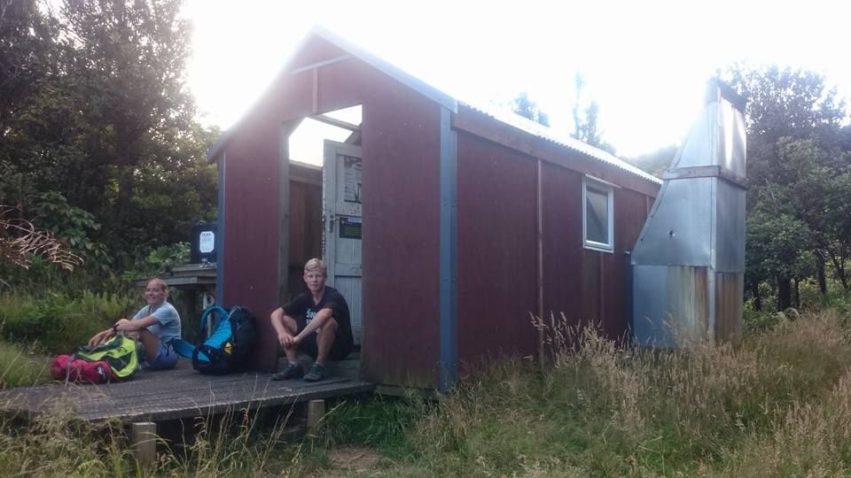
So we pushed on north, rather footsore, eventually reaching Thompsons Track where a couple of dirt bikers were having a blast. More uphill then undulating through a large open grass area, remnant of an old farm. The track through here was a bit like a hedge maze as we wound our way through shrubbery. On re-entering the bush the track became quite rough and indistinct - it wouldn't have been easy to follow in the dark. A brief sit down at the Eliza mine turn off gave us the energy required for the final push to Motutapere Hut which sits at 580m. A tough 11.5 hours after striking camp we finally reached the hut and collapsed on the deck. First priority was to remove wet shoes to let shrivelled and mushy feet dry out! Motutapere Hut has recently been done up by the deerstalker association, and the 3 bunk hut has a good outlook towards Mt Maunganui. As darkness fell we were treated to a spectacular display of lightning over Tauranga with clouds lighting up every few seconds. We drifted off to sleep to the pitter patter of mice scurrying about in the roof.


The next morning the hut was shrouded in cloud although the air was warm and still. Clambering along rocky outcrops we caught glimpses of the sun shining down on the western plains. An hour of undulating over many intriguing rocky knobs (from which I am sure there is a good view) brought us to the junction with Tuahu Track. Reegan managed to brush his hands through stinging nettle but luckily the reaction wasn't too severe.


From the junction it was another hour through to Te Rereatukahia Hut. This track was even more overgrown with grass and because everything was wet the seeds stuck to my legs and shorts, needling me at every step. This hour was my least favourite of the whole trip. As we descended down to the Wharawhara valley on a benched track the cloud turned to rain, bucketing down by the time we reached the river. The next few kilometres followed alongside the river, crisscrossing several times near the top. As the track leaves the stream it crosses a little side stream which forms a series of cascades and plunge pools. Reegan eyed up the narrow mossy chute and was soon careering down the best natural water slide I have ever seen. After a few backflips into the top pool it was time to attack the climb up to Cahsmore's Clearing. It gradually got muddier under foot but most of the bogs could be danced around. This section of track between the Wharawhara and Waitawheta valleys was the only muddy bit of the whole North-South track. A steep, rooty, slippery descent into the upper Waitawheta where the track follows an old logging route down to Waitawheta Hut. We passed an incredible large, deep round swimming hole at the base of a waterfall but opted not to take the plunge due to the inclement weather. On a sunny day it would be a lovely spot. The sun came out during our late lunch break at Waitawheta Hut.

The next 6km along the old tramline beside the river was extremely hard on the feet as it was paved with unforgiving uneven rocks. We flew along in 1:20 hours as we were eager to finish this section. A final 1.5km push uphill to Daly's Clearing Hut and we were done. Finishing at 5pm was gentlemen's hours! We spent the evening eating, drying out gear, resting our feet and sitting on the deck chatting to the other two hut occupants.

I slept soundly, and the drizzly morning was conducive to lazing in bed. However Dan was keen to push on to catch the 2pm bus out of Paeroa so we hit the road at 8am. From Daly's Clearing to Karangahake is 13.5km of old pack tracks which make for easy going. There is only one steep descent before following the river down to SH2. There are several excellent swimming holes en route but the weather was not particularly conducive to taking a dip.

All too soon civilisation was reached at Karangahake Gorge - tourists, cars, and noise. We joked that this was our turn around point and it was now time to head south back to Lower Kaimai. But I was only half joking. Given enough food I would have been much happier spending another 3 day tramping through the bush than heading into town. Dan and Reegan were just keen to hit McDonalds (and demolish a family box each)! Dan rang Intercity to change our tickets to the 2pm bus only to discover that it was full. Drat! Now we would have 6 hours to fill in at Paeroa.

From Karangahake we followed the new Hauraki Rail Trail bike path. Now that the time pressure was off we dawdled the final 5km along the flat gravel path. 71 hours after hopping off the bus at Lower Kaimai we reached the L&P bottle in Paeroa. FINIS! It had been the hardest and fastest tramp I have done for a while and I thoroughly enjoyed it.


One great thing about the North-South track is the variety. Every couple of hours the nature of the bush changed completely. From lush rain forest to mamaku stands and nikau groves; scrubby bush to tall remnants of the old forest. There were flat trails, rocky ridge lines, rivers and everything in between. The Kaimai Ranges may not have the grandeur of the South Island but they are still very interesting. The one common factor along the trail was the grass. Loads of hook grass and knee high grasses with sharp seed heads which find their way into your boots, socks, shorts and everywhere else.

Photos by Dan & Reegan


GPS track